Hi there,
We currently have three MODULAIR sensors placed in Providence, RI that are located about 3.5 miles apart from each other (on average). I was digging through the NO2 readings since around December 16 2024 - April 31 2025. In the process of analyzing the data, I found that there are extended periods of time when all three sensors, despite their distance apart, will all read almost exactly 7.29 for several hours straight. I have yet to dig very deeply into the data, but it does seem moderately frequent.
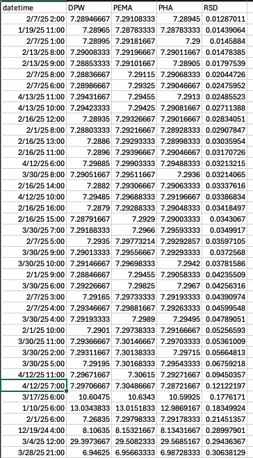
I calculated the relative deviation (RSD) between each of the three sites, averaged every hour. The following screenshots show specific hours when the deviation between the sites was lowest. The top 34 times for when the sites were most similar in reading, they all read almost exactly 7.29 ppb NO2 for the entire hour.
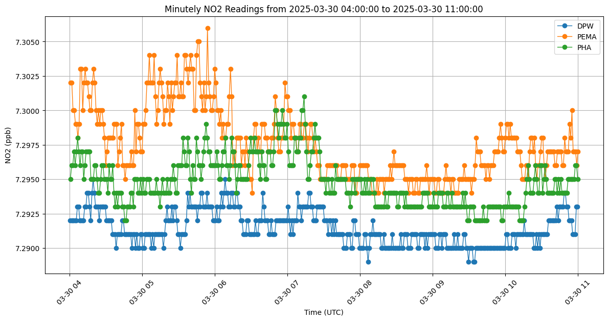
Here is an example of minutely data that demonstrates what one of these anomalous time periods look like, when all readings are extremely similar:
I will look into this further, but I was wondering if anyone on the team was aware of this type of anomaly and if there are any sources of it (maybe a weird calibration artifact?). It should be entirely impossible for the sites located miles apart to read within a hundredth of a ppb, so I’m wondering if I should disregard this data. The goal is to eventually utilize the MODULAIR sensors for other LCS calibration, so knowing whether to trust this data is pretty important.
I can provide more data if needed. Thanks!
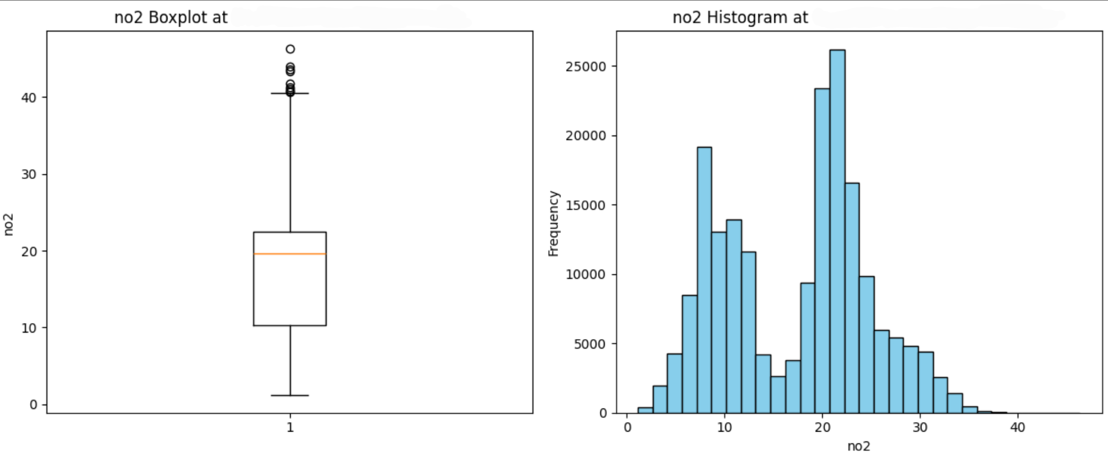
P.S.- Just remembered I have a histogram of no2 at one of the sites. Seems to be bimodal with one peak at around 7?